Winter Surveys in the Gulf of Alaska and Southeastern Bering Sea Near Bogoslof Island
Figs. 8-10
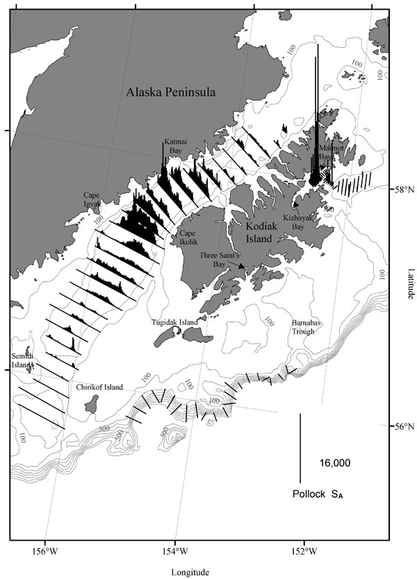
Figure 8 (Above). Acoustic backscattering (sA) attributed primarily to walleye pollock (vertical lines) along transects during the 19 March-1 April 2009 acoustic-trawl surveys along the Gulf of Alaska shelf break from Chirikof Island to Barnabas Trough, the Shelikof Strait area, and Marmot Bay.
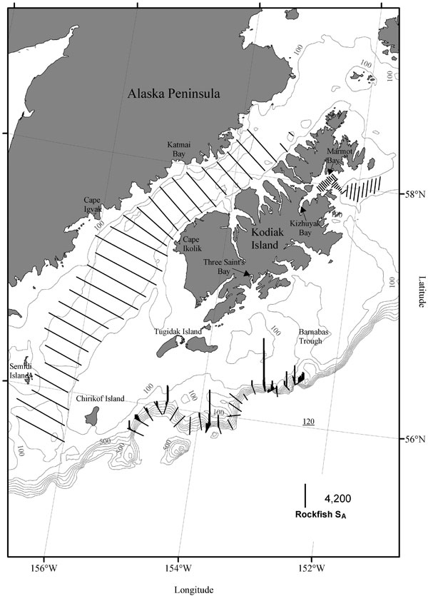
Figure 9 (Above). Acoustic backscattering (sA) attributed primarily to Pacific ocean perch (vertical lines) along transects during the 19 March-
1 April 2009 acoustic-trawl surveys along the Gulf of Alaska shelf break from Chirikof Island to Barnabas Trough, the Shelikof Strait area, and Marmot Bay.
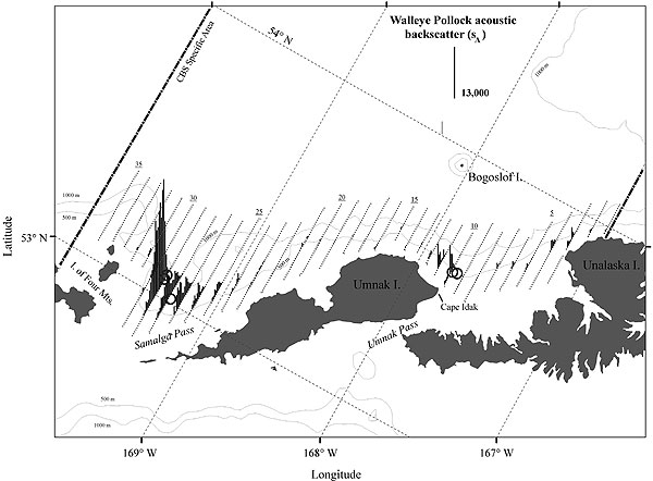
Figure 10 (Above). Acoustic backscatter (sA) attributed to walleye pollock (vertical lines) along tracklines during the 7-15 March 2009 acoustic-trawl survey of walleye pollock in the southeast Aleutian Basin near Bogoslof Island. Trawl haul locations are indicated by circles, and the Central Bering Sea Convention area is indicated by a dash-dotted line.