|
|
| Error processing SSI file |
|
||||
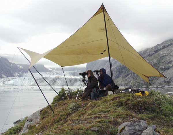
Harbor seals in Alaska occupy a geographically extensive range and topographically diverse haul-out habitats, hauling out on a variety of substrates including sand, rock, and ice. Aerial surveys of harbor seals are most often conducted when peak numbers are hauled out, which usually occurs during the seals’ annual molt during late summer. These surveys utilize low-altitude (100-300 m) photographs of harbor seal groups, from which seal counts are made. In Glacier Bay, harbor seal numbers declined by 75% (-14.5%/yr) from 1992 to 2002 at terrestrial resting sites and by 64% (-9.6%/yr ) from 1992 to 2001 in Johns Hopkins Inlet, Glacier Bay, the primary breeding site, which is a glacial fjord. Surveying seals in glacial fjords is difficult because the ice upon which seals haul out moves, large expanses of scattered ice offer little spatial reference to aid in counting seals, and there is often insufficient maneuvering room for low-altitude aerial surveys in the fjords. Because it is estimated that 10% or more of harbor seals in Alaska use glacial ice habitats during the molting season (August – September) each year, there is a pressing need to develop reliable survey techniques to assess harbor seal abundance in such areas. This feature article evaluates two such survey methods: shore-based counts and large-format aerial photography. Read the complete article>>>
|
|
AFSC Quarterly Research Reports Oct-Dec 2004 ContentsFeature Items ABL Reports NMML Reports RACE Reports REFM Reports Quarterly Index Quarterly Home |
||
|
|
||||
|
|
||||