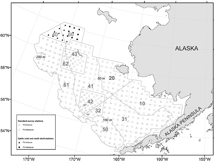
Figure 1. Standard and special study stations sampled during the 2007 eastern Bering Sea bottom trawl survey.
Geographic regions shown indicate strata used for analysis of groundfish catch data.
|
Figure 1. Standard and special study stations sampled during the 2007 eastern Bering Sea bottom trawl survey. Geographic regions shown indicate strata used for analysis of groundfish catch data. |