|
|
| Error processing SSI file |
|
||||||||||||||||
Polar Ecosystems ProgramHarbor Seals Census in Bristol Bay and Along the Alaska Peninsula
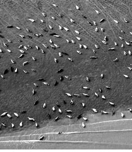
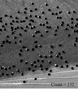
The Polar Ecosystems Program (PEP) conducts aerial surveys for abundance of harbor seals in Alaska every August during the
seals’ molt, when they spend much of their time out of the water. For logistical purposes, Alaska is divided into five regions,
and one region is surveyed each year. The five regions are the north side of the Alaska Peninsula and Bristol Bay (surveyed this
year); Gulf of Alaska (2006), northern Southeast Alaska (2007), southern Southeast Alaska (2008), and the Aleutian Islands (2009). Photogrammetry Sampling of Molting Harbor Seals in Icy and Disenchantment Bays
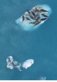
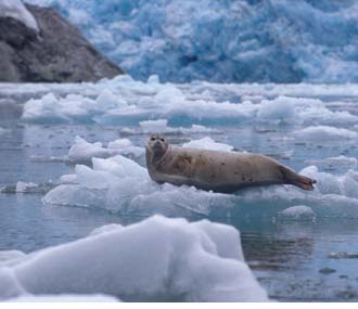
PEP completed its field studies for 2005 on the disturbance of harbor seals by cruise ships in Disenchantment Bay, Alaska, near
Yakutat. Nearby Icy Bay is not visited by cruise ships and is studied as a control. Both sites are tidewater glacial fjords where
seals haul out on floating ice throughout the year. From May to September 2005, spanning the pupping and molting periods for harbor
seals, Disenchantment Bay received about 170 visits from cruise ships. The Yakutat Tlingit Tribe relies on harbor seals for subsistence
and has raised concerns about a perceived decline in the abundance of harbor seals since cruise ship visits began increasing from the
15 that occurred in 1989.
Throughout both survey periods, observers from the PEP and the Yakutat Tlingit Tribe continued to board cruise ships in Disenchantment Bay to collect data on ship movements and seal density in relation to ship approach distance. Meteorological data were collected via automatic weather stations installed at both sites. Because the molting season can be energetically demanding for seals, requiring them to haul out for longer periods without feeding when compared to other times of the year, the seals may be more sensitive during molting to disturbance by cruise ships.
In addition, large-format photogrammetry (AFSC Quarterly Report October - December 2004) of the entire area was conducted daily from 9-11 August 2005 to provide an estimate of the total number of seals present during molting. Although these surveys are part of our ongoing efforts to estimate the statewide abundance of harbor seals, we were able to conduct our sampling photogrammetry at the same time on each of the 3 days to allow for direct comparisons between the two methods. These comparisons will ultimately provide the means to cross-validate the two methods and examine potential biases. By John Jansen and Shawn Dahle |
|
AFSC Quarterly Feature ABL Reports FMA Reports NMML Reports RACE Reports REFM Reports Items Quarterly Index Quarterly Home
|
||||||||||||||
|
|
||||||||||||||||
|
|
||||||||||||||||